Extending south from the main part of Walnut Canyon are a number of smaller, shorter side canyons. Further down one of these canyons, the rock walls quickly close in and steepen. The shade cools the canyon by providing cover from the warm summer sun, creating a “microclimate” that is taken advantage of by the many trees that grow in this canyon. These include the walnut trees that gave the canyon its name. Eventually, it dead-ends at a major obstacle, a “pour-off” where there can be a waterfall and splash pool during the spring snowmelt, or during the summer monsoon season when thunderstorms come to northern Arizona. The splash pool would also have been a good source of water when full; in the picture below, it’s completely dry thanks to a below-normal precipitation monsoon.
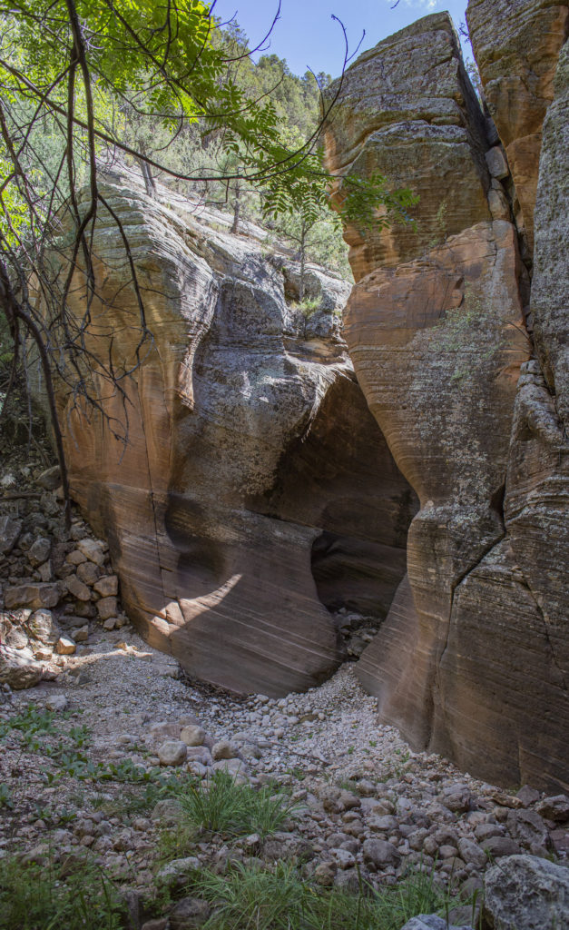
As evidenced by the dense cultural remains, the prehistoric inhabitants of Walnut Canyon knew of this location, and took advantage of its resources. If you take a 360-degree view of this spot, you will see both a rock shelter and a wall full of petroglyphs.
Many of the boulders on the ground in and near the shelter have “grinding slicks”, smooth ground depressions likely used for processing seeds and nuts gathered from the canyon. Some of them also have a few petroglyphs near them. Click on the numbers in the 3D model below for views of several of these.
Off to the right of the rock shelter is a rock wall with the 2nd-largest petroglyph panel in Walnut Canyon National Monument. The 3D model below displays the panel; click on the number icon in the 3D model to zoom to an interesting bird petroglyph located on the boulder to the lower left of the main panel.
For closer looks at the petroglyphs and grinding slicks, both in higher resolution and altered lighting, visit the “223 – A Closer Look” and “223 – In A Different Light” pages.