Though best known for the Ancestral Puebloan ruins of the front country, prehistory in Wupatki National Monument extends back in time thousands of years to the Paleoindian period, when people made their living by hunting game animals and gathering wild foods.
From around 13,000 to 10,000 years ago, the landscape of Wupatki was vastly different than today, and was likely populated with now-extinct megafauna such as mammoth, bison, camels, horses, and giant sloth. People during this period were highly mobile, moving frequently and at times covering great distances, perhaps following the same paths of their prey species.
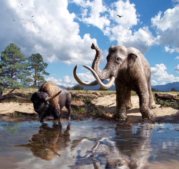
Recreation of the Pleistocene environment of Wupatki National Monument by Victor O. Leshyk and Christian E. Downum.
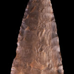
This movement is reflected in a Clovis projectile point found within the Monument. Made on Black Tank Obsidian, this point indicates that nearly 13,000 years ago, people traveled through the raw stone source some 50 miles away before reaching what is now Wupatki National Monument.
-
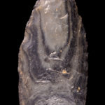
- Clovis point
-
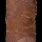
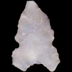
- Plainview-style point
A later-dating Plainview-style projectile point was also recovered from within Wupatki Pueblo itself. Picked up from an unknown location on the landscape, this point was brought to the pueblo thousands of years after its original loss.
Around 10,000 years ago, modern vegetation communities and climatic regimes began to take hold in northern Arizona. The megamammals of the preceding period no longer roamed the region, and people began to focus more on plant resources, with increasing reliance on plant foods and permanency in territory, and later, residence, occurring over the next 6,000 years.
Projectile points dating to this period in Wupatki represent two separate traditions—one with Great Basin-type points and the other that of the Cochise Culture, thought to be ancestral to several Southwest archaeological traditions, including the Mogollon and Hohokam. Other artifacts common to the broad sweep of the Archaic period are also shared across much of the Southwest, including sandals, baskets, and groundstone tools used to process plants and seeds.
-
- Elko-style point
-
- Chiricahua-style point
The end of the Archaic period in the northern reaches of the Southwest is marked by the adoption of maize (corn) agriculture. On the Colorado Plateau, where Wupatki National Monument is located, this occurred perhaps as early as 4,000 years ago during the Basketmaker II period. People began to live in small, open-air pithouse villages, and based on the discovery of early irrigation canals near Zuni, New Mexico, even early farmers on the Colorado Plateau had knowledge of irrigation systems for maize agriculture. They also had domestic dogs, complex weaving technology, and shell jewelry that came from as far away as the Gulf of California.
Shortly after the adoption of maize, people also began to grow squash, and then beans. New technologies including the bow and arrow and pottery were also present by around A.D. 500, and larger houses became the norm. Sites dating to this period within Wupatki include an early agricultural site located beneath the amphitheater at Wupatki Pueblo, as well as the Hieser Springs pithouse group.
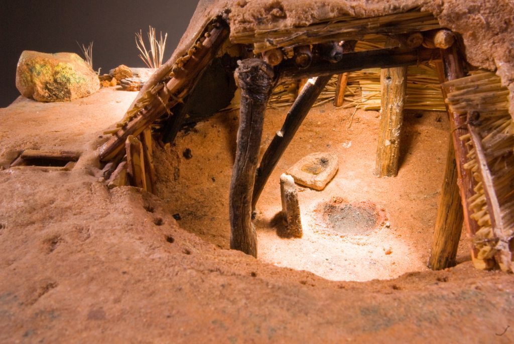
Cut-away view of a pithouse. Clicking this image will take you to additional views of the model.
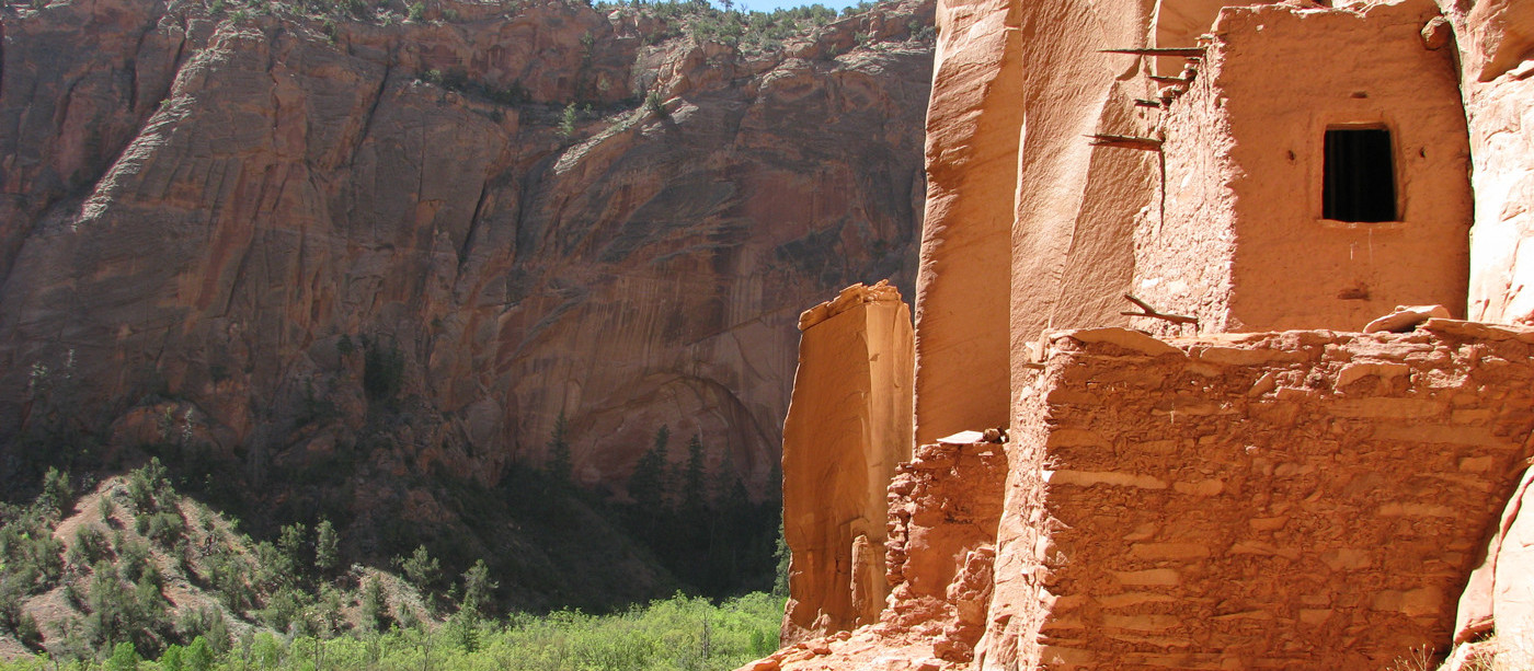
Between A.D. 700 and 900, people began to construct above-ground rooms, which after A.D. 900 became multi-story masonry structures sometimes several stories tall. Wupatki’s most extensive period of occupation, however, dates after this period and the eruption of Sunset Crater Volcano only a short distance south.
Believed to have occurred over a period of months to a few years in the last quarter of the 11th century, the volcano’s eruption would have been visible to people living as far away as western New Mexico, and when complete, had blanketed much of the region in a thin layer of volcanic cinders through by many to have provided a water-retaining mulch contributing to the success of local farmers in the greater Flagstaff area.

The curtain of fire from the Sunset Crater volcano eruption would have been visible at great distances.
Both displaced by the eruption and likely drawn to the area by the same, people flocked to the Wupatki region, resulting in the construction of the majority of the masonry pueblos for which the Monument is known, including Wupatki Pueblo, Citadel, and Wukoki. The builders appear to have had at least three different cultural origins, known to archaeologists as the Cohonina, Sinagua, and Kayenta.
These cultural groups practiced similar lifestyles, but the ceramics and projectile points of each were quite different in style and design, as were certain architectural attributes, as well.
Cohonina people, for example, manufactured a pottery type known as San Francisco Mountain Gray Ware and favored long unnotched projectile points. Sinaguan people made a ceramic ware called Alameda Brown Ware and projectile points triangular in form and serrated along the margins, and Kayenta people manufactured Tusayan White Ware, a type of pottery decorated with black paint, and notched triangular projectile points.
Cohonina, Sinagua, and Kayenta materials are often found together in the Monument, suggesting these Ancestral Puebloans lived and farmed together in what is now Wupatki National Monument perhaps as late as the early A.D. 1300s, after which people migrated away from the area. Amongst their descendants are the modern Hopi, and possibly some of the modern Zuni, as well. Hopi people refer to the Sinagua, Kayenta, and Cohonia peoples as Hisatsinom, or “people of long ago.”
After the migration of Ancestral Peubloans out of Wupatki, the Monument remained without permanent residents until Navajo (Diné) people moved into the region centuries later. The Navajo name for Wupatki is Anaasází bikin (Ancient People’s Home). Navajo people lived in and around Wupatki until 1864, when the U.S. Army forced the Navajo on the “Long Walk,” a journey of 500 miles to Fort Sumner, New Mexico, also known as Bosque Redondo and called by the Navajo Hwéeldi, Land of Suffering.
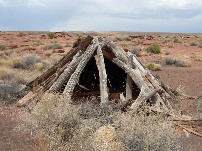
Forked-stick hogan. Photo by Meghann M. Vance.
Peshlakai Etsidi (Béésh łigai Itsidí, meaning Silversmith), along with his wives, returned to the Wupatki area following release from Fort Sumner in 1868, and became one of the most prominent Navajo people in the area of the Little Colorado River, which borders the eastern edge of the Monument. Within less than a decade, however, tensions between the Navajo people and the Anglo ranchers also using the Wupatki area led to conflict over water sources, land use, and ownership. Taxation and intimidation were used to drive the Navajo people from the Wupatki Basin and areas to the north.
In 1902, Peshlakai Etsidi traveled to Washington D.C. to meet with President Theodore Roosevelt. As a result, an allotment program was set up for the Navajo people and their grazing rights in the region. In 1924, Wupatki National Monument was established, beginning the tenure of the National Park Service in the Wupatki area. Clyde Peshlakai, Peshlakai Etsidi’s son, was acting custodian of the Monument in the 1930s.
Establishment of the original Monument had little impact on Navajo use of the Wupatki Basin, but expansion of the Monument in 1937 brought four large Navajo residential use areas under the jurisdiction of the National Park Service. Navajo people continued to live and graze their sheep on Monument lands until the late 1950s and early 1960s. By 1964, however, only the Peshlakai family remained in residence. The daughter of Clyde Peshlakai holds the last special-use permit allowing Navajo people to live and graze their sheep on Monument lands. Upon her death, her lands will revert to the National Park Service.