The Lava Flow Trail at Sunset Crater Volcano National Monument is a self-guided moderate 1 mile (1.6 km) trail with rough surfaces. The trail explores the unique environment created by a volcanic eruption. Your options include a short accessible loop (1/4 mile, or 0.4 km) or a longer moderate walk to the base of Sunset Crater (1 mile, or 1.6 km).
This virtual trail guide mimics the paper trail guide and benchmarks you would experience in person when walking the full trail. Portions of the trail may also be viewed as 360-degree panoramas by following this link and then clicking on the trail markers.

About 1,000 years ago, something spectacular happened in the lives of local Native peoples. Perhaps they first observed a change in animal behavior. Maybe they noticed the ground warming. Then the tremors increased in number and intensity. By the time the earth cracked open, people had their belongings packed. What followed impacted life profoundly in this corner of the Southwest. A 1,000-foot-high (305 m) cinder cone, known today as Sunset Crater, grew where open parks and forests had been. Volcanic ash buried about 64,000 acres of potential farmland. Many people lost their homes and livelihoods. Stories symbolizing the significance of the eruption were told and retold. Word of the phenomenon may have spread across the continent. Today, the area’s American Indian groups consider this a sacred landscape where life was cleansed, where a connection exists to the world below and the universe above… a landscape that cautions, reminds, and teaches.
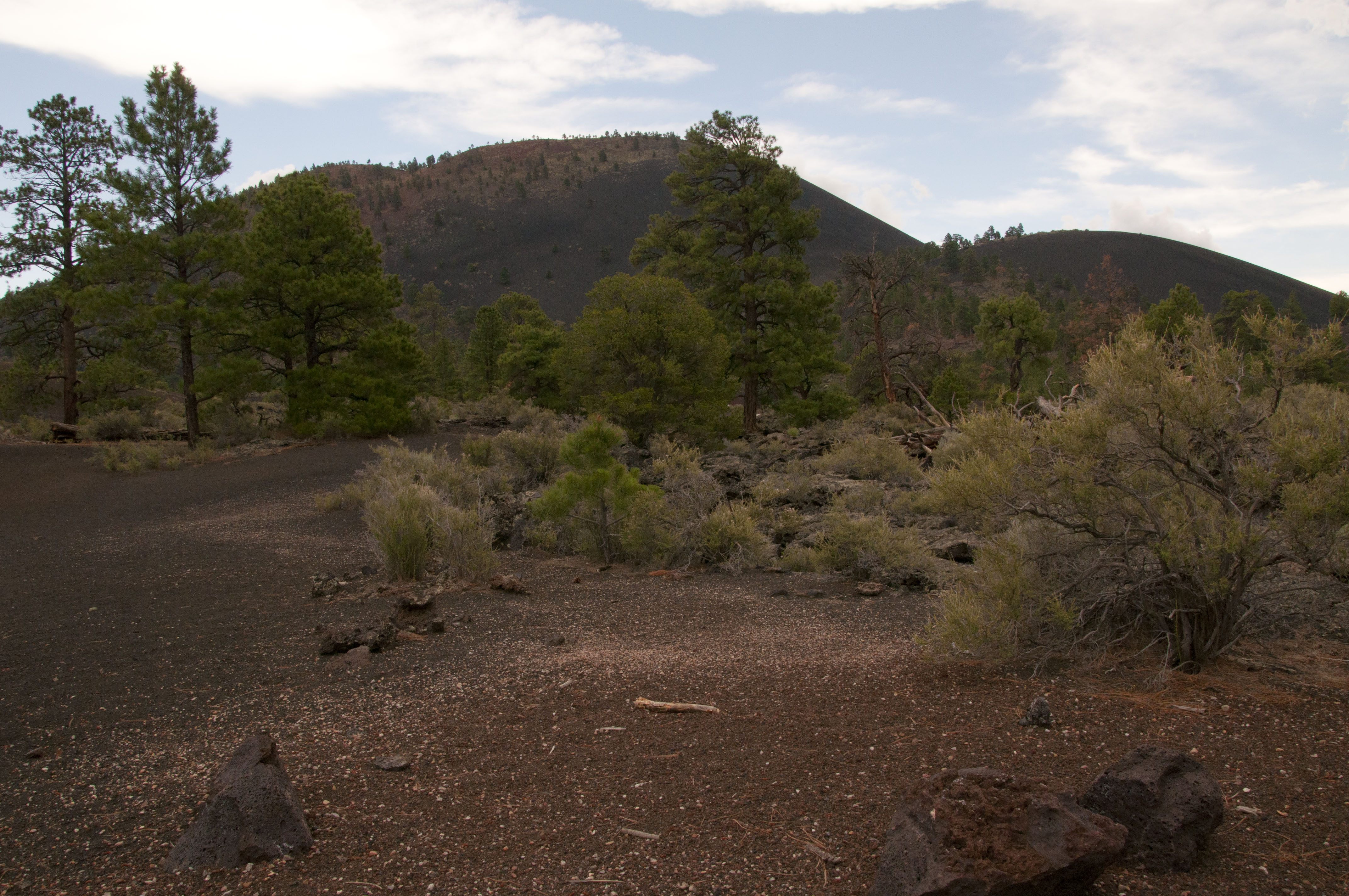
 Alpine slopes, forests, and grassy parks disguise the fiery, molten, and often explosive history of this region’s landscape. But here, amidst the Bonito Lava Flow and Sunset Crater’s cinder fields, the land’s volcanic origin is revealed in stunning clarity.
As you walk the trail, use this guide to explore the powerful forces—rapid and violent, slow and patient—that continually shape our planet. These forces all affect our lives and provide for life in ways we may not realize.
Patterns often reveal forces otherwise invisible to us. As you cross the bridge, look to your right for a small light-colored rock embedded in the dark basalt rock. This is a xenolith (zee-no-lith), a rock fragment foreign to the body of rock in which it occurs. When magma rose to the surface, it brought up pieces of limestone from 700 to 1,000 feet below us.
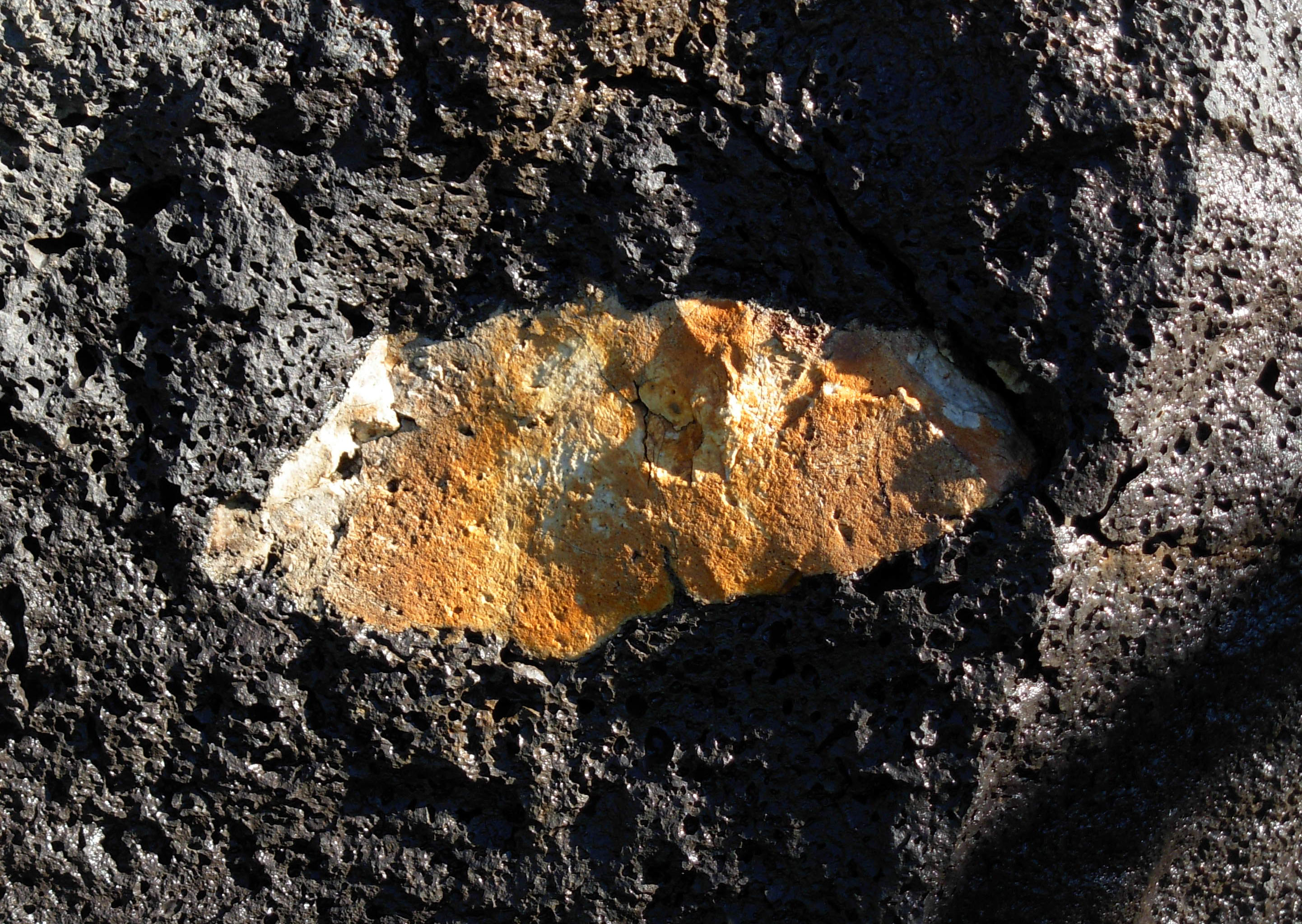
Limestone zenolith in the basalt.
Uplift and erosion have exposed this rock (known as Kaibab Limestone) elsewhere: at the rims of the Grand Canyon and nearby Walnut Canyon and in cliffs at Wupatki National Monument.
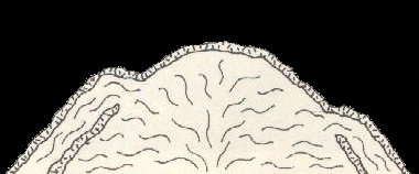
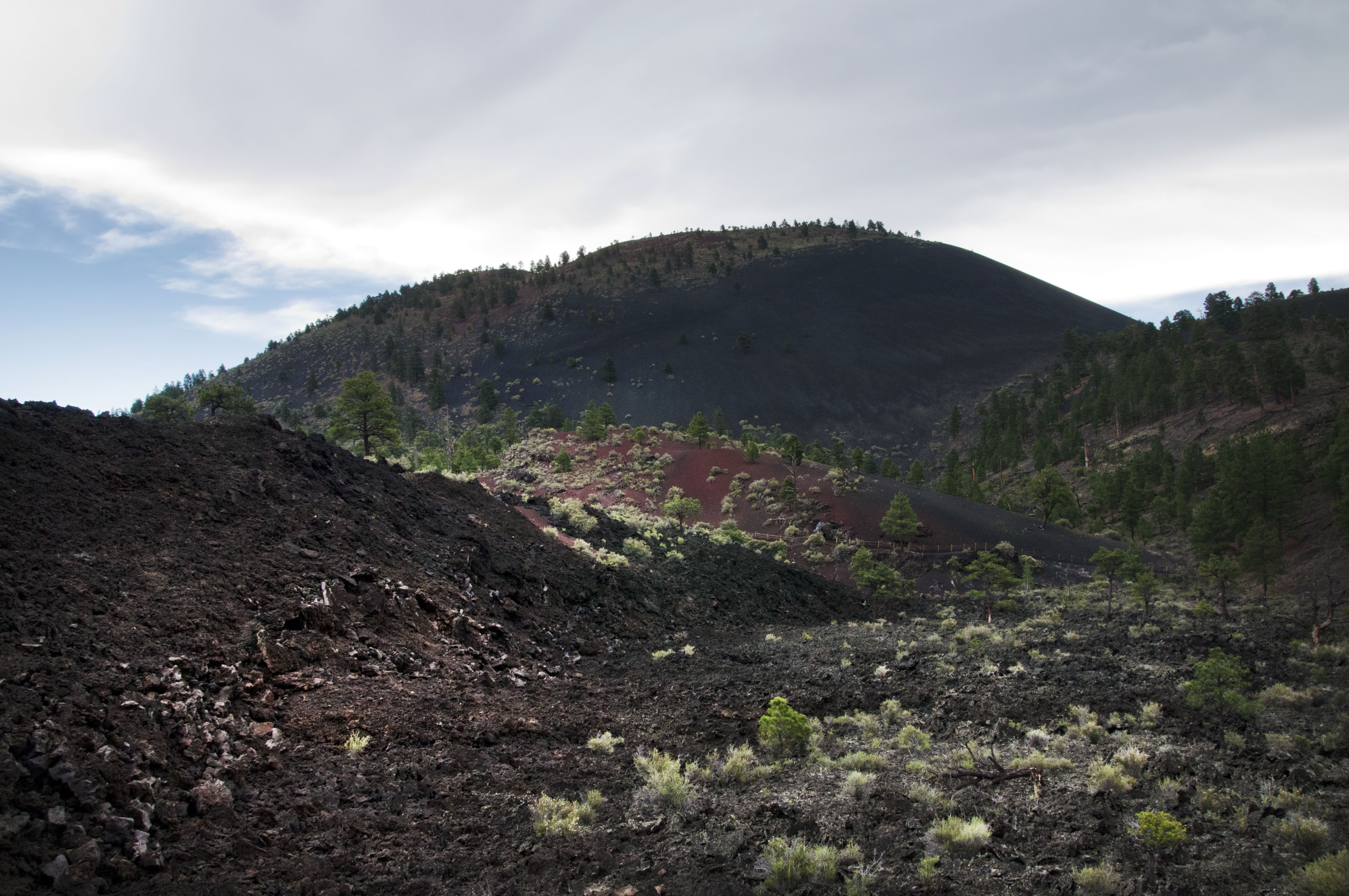
 Sunset Crater rises before you, a nearly symmetrical cone. Its perfect shape suggests a simple eruption history, but that was not the case. In fact, it wasn’t until the 1980s that scientists began to understand the complexity and extent of the eruption.
Sunset Crater.
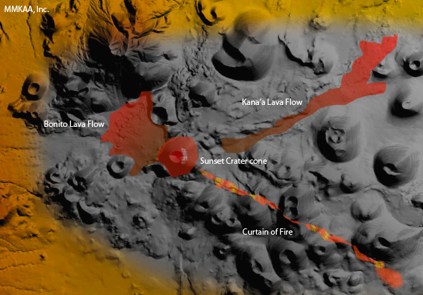
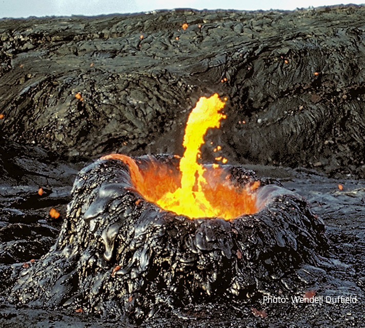
First, molten rock (magma) and gasses pushed up to the earth’s surface along a six-mile-long weak spot or fissure in the earth’s crust. Volcanic fragments, called pyroclasts, shot upward along the fissure in a “curtain of fire” as gasses escaped violently. Small cinder cones formed along this fissure before the magma became focuses and erupted as a lava fountain from a primary vent. A large cone (Sunset Crater) grew as the shower of cinders and ash piled up around the vent.

Curtain of fire.
Meanwhile, lava broke out of the base of this side of the cinder cone forming the Bonito Flow all around you. The lava pooled, trapped by surrounding older volcanoes, and accumulated to perhaps 100 feet (30 m) thick during at least three separate flows. On the opposite of the cone, lava flowed more than six miles (10 km), filling a narrow valley.
- Eruption date: sometime between AD 1040 and 1100
- Height: 1,000 ft (305 m)
- Elevation at summit: 8,029 feet (2,447 m)
- Diameter at base: 1 mile (1.6 km)
- Diameter at top: 2,250 feet (868 m) from rim to rim
- Depth of crater: 300 feet (91.4 m)
- Extruded material: approximately 1 billion tons
- Extent of ashfall: approximately 800 square miles (2,072 sq km)
When the volcano coughed out its last cinders – after several months or perhaps several years – they were colored by the oxidation of iron in the magma. Similar to the way metal rusts, the magma came in contact with water-rich gasses emitted during the final stages of the eruption. These red cinders rim the top of the cone.
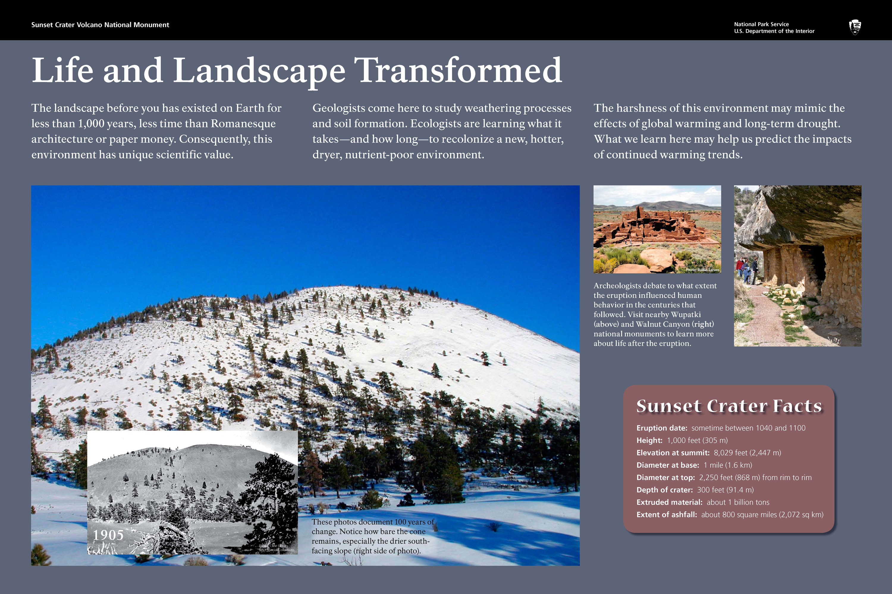
The landscape before you has existed on Earth for less than 1,000 years, less time than Romanesque architecture or paper money. Consequently, this environment has unique scientific value. Geologists come here to study weathering processes and soil formation. Ecologists are learning what it takes—and how long—to recolonize a new, hotter, dryer, nutrient-poor environment. The harshness of this environment may mimic the effects of global warming and long-term drought. What we learn here may help us predict the impacts of continued warming trends.
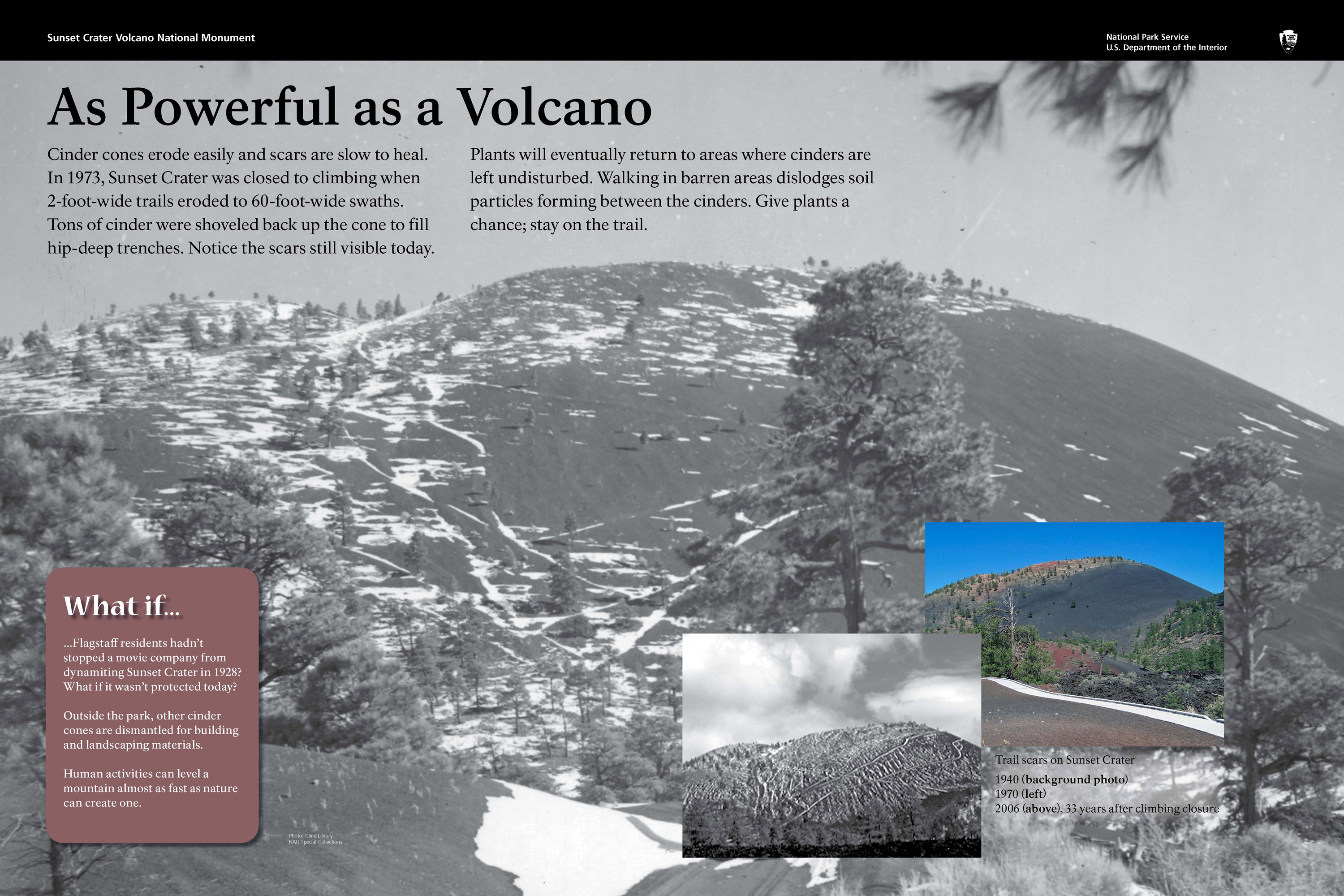
Cinder cones erode easily and scars are slow to heal. In 1973, Sunset Crater was closed to climbing when 2-foot-wide trails eroded to 60-foot-wide swaths. Tons of cinder were shoveled back up the cone to fill hip-deep tranches. Notice the scars still visible today. Plants will eventually return to areas where cinders are left undisturbed. Walking in barren areas dislodges soil particles forming between the cinders. Give plants a chance; stay on the trail.
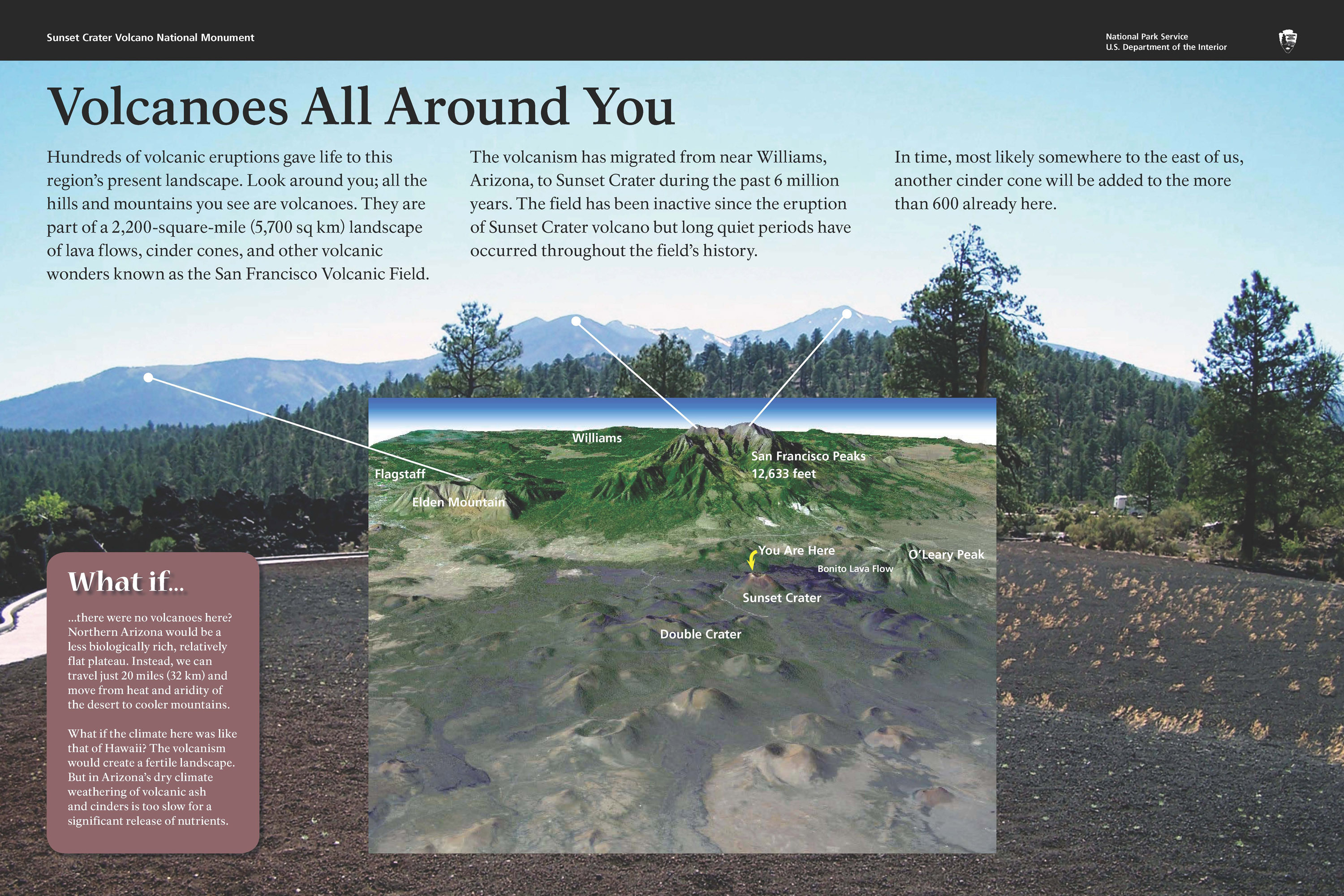
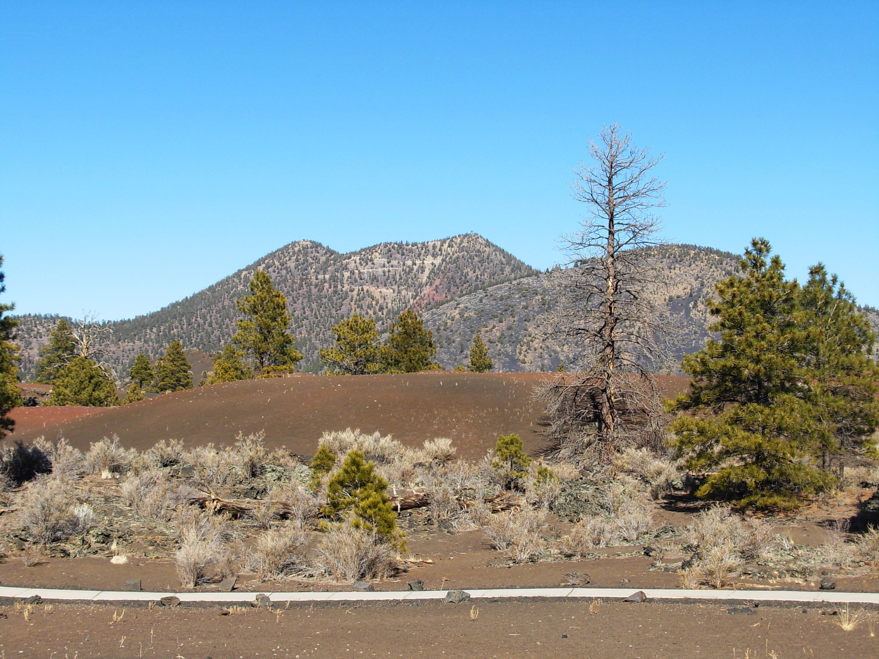
Hundreds of volcanic eruptions gave life to this region’s present landscape. Look around you; all the hills and mountains you see are volcanoes. They are part of a 2,200-square-mile (5,700 sq km) landscape of lava flows, cinder cones, and other volcanic wonders known as the San Francisco Volcanic Field. The volcanism has migrated from near Williams, Arizona, to Sunset Crater during the past 6 million years. The field has been inactive since the eruption of Sunset Crater volcano but long quiet periods have occurred throughout the field’s history. In time, most likely somewhere to the east of us, another cinder cone will be added to the more than 600 already here.
 At nearly 1,000 years young, Sunset Crater volcano is a geological infant, the latest development in a series of eruptions that have taken place here over the past 6 million years. It is only a small part of the impressive San Francisco Volcanic field of northern Arizona.
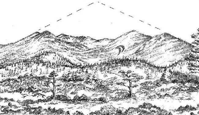
From this point, three different types of volcanoes are visible. What makes a volcano tall or short, steep or gentle, or an eruption more or less violent? Mostly the magma’s stickiness or viscosity, which is determined by its chemical composition and gas content.
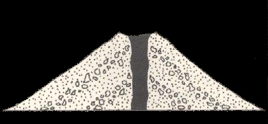
Cinder cones, like Sunset crater and most of the 6000 or so volcanoes in this field, tend to be cone shaped with sides not steeper than 33 degrees. A cinder cone is literally a pile of loose fragments. It is easily eroded and will change shape, becoming less steep as it ages.
Sunset Crater is a cinder cone.
Look for a dome volcano (O’Leary Peak) on the horizon in front of you. Dome volcanoes tend to have steep sides and rounded shape.
O’Leary Peak is a dome volcano.
 Composite or stratovolcanoes have sharp peaks or less steep sides. Mount St. Helens, Mount Fuji, and the San Francisco Peaks, seen here in the distance, are examples of this classic volcano type.
The San Francisco Peaks are the remnants of a stratovolcano.
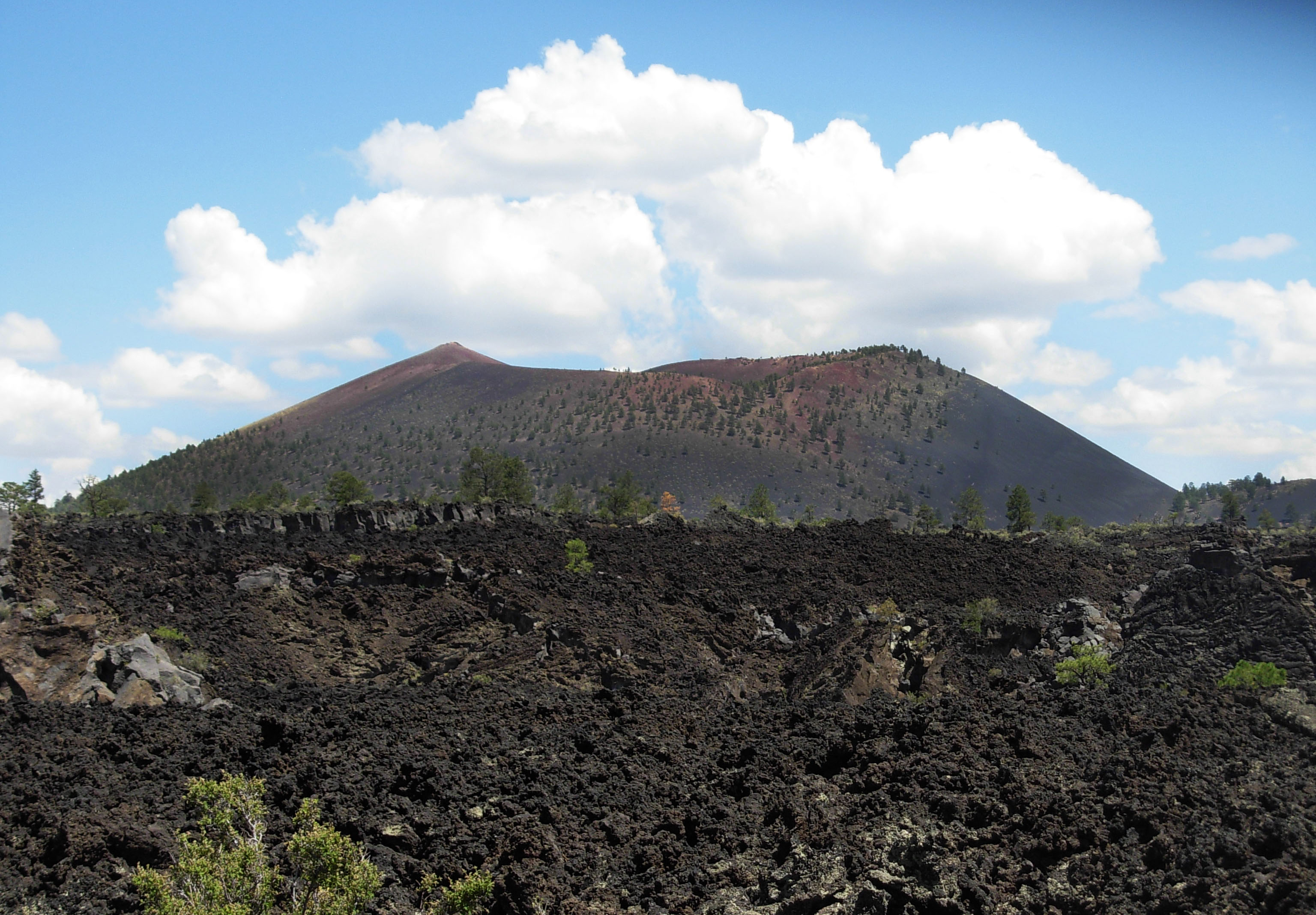
 You are now on the southern edge of the Bonito Lava Flow. Magma, periodically relieved of gas pressure, squeezed out of the base of the cone as glowing liquid lava, creating a structurally complex flow covering 2 sq miles (5 sq km).
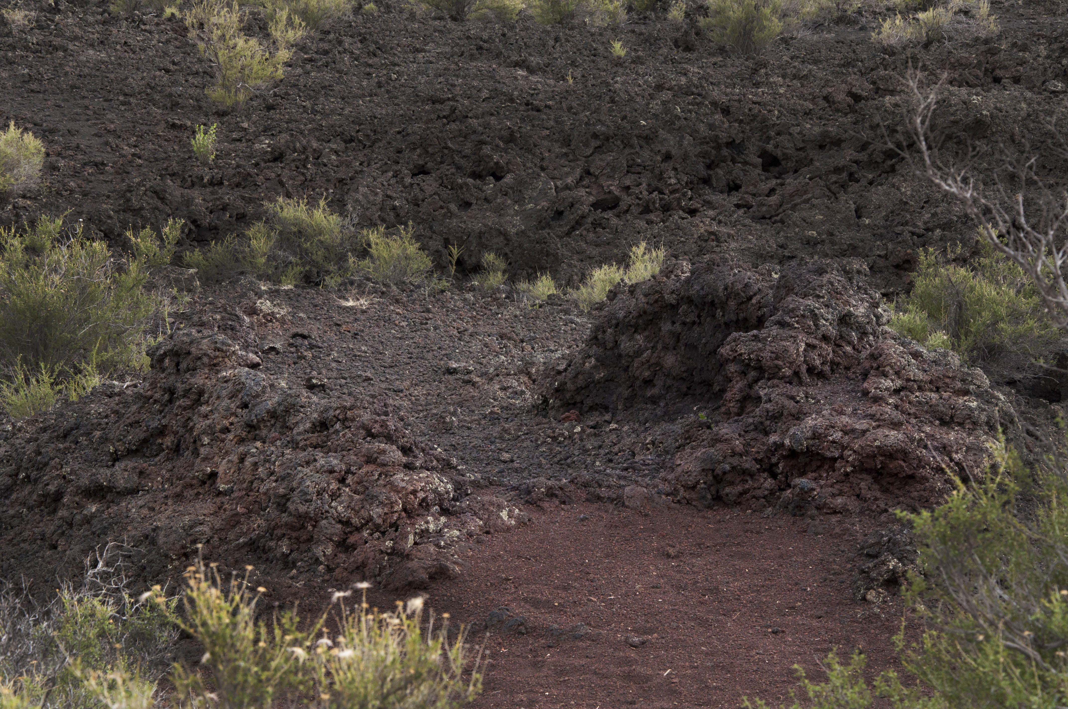
Lava flows tend to form either jagged blocks, known as aa (ah-ah), or a smooth, ropey surface of pahoehoe (pa-hoy-hoy). Flows usually start as pahoehoe, thin and runny. As the lava cools and becomes more thick and pasty, it can change into an aa flow. The Bonito Flow is mostly aa lava. When aa is forming, cooled, hardened blocks – sometimes called clinkers – are rafted along the surface of moving lava, making clinking noises as they tumble into each other.
The Bonito Lava Flow and Sunset Crater beyond.
Although its structure is complicated, the flow’s composition is uniform throughout. The lava and cinders around you, whether black or red, ropey or jagged, are basalt.
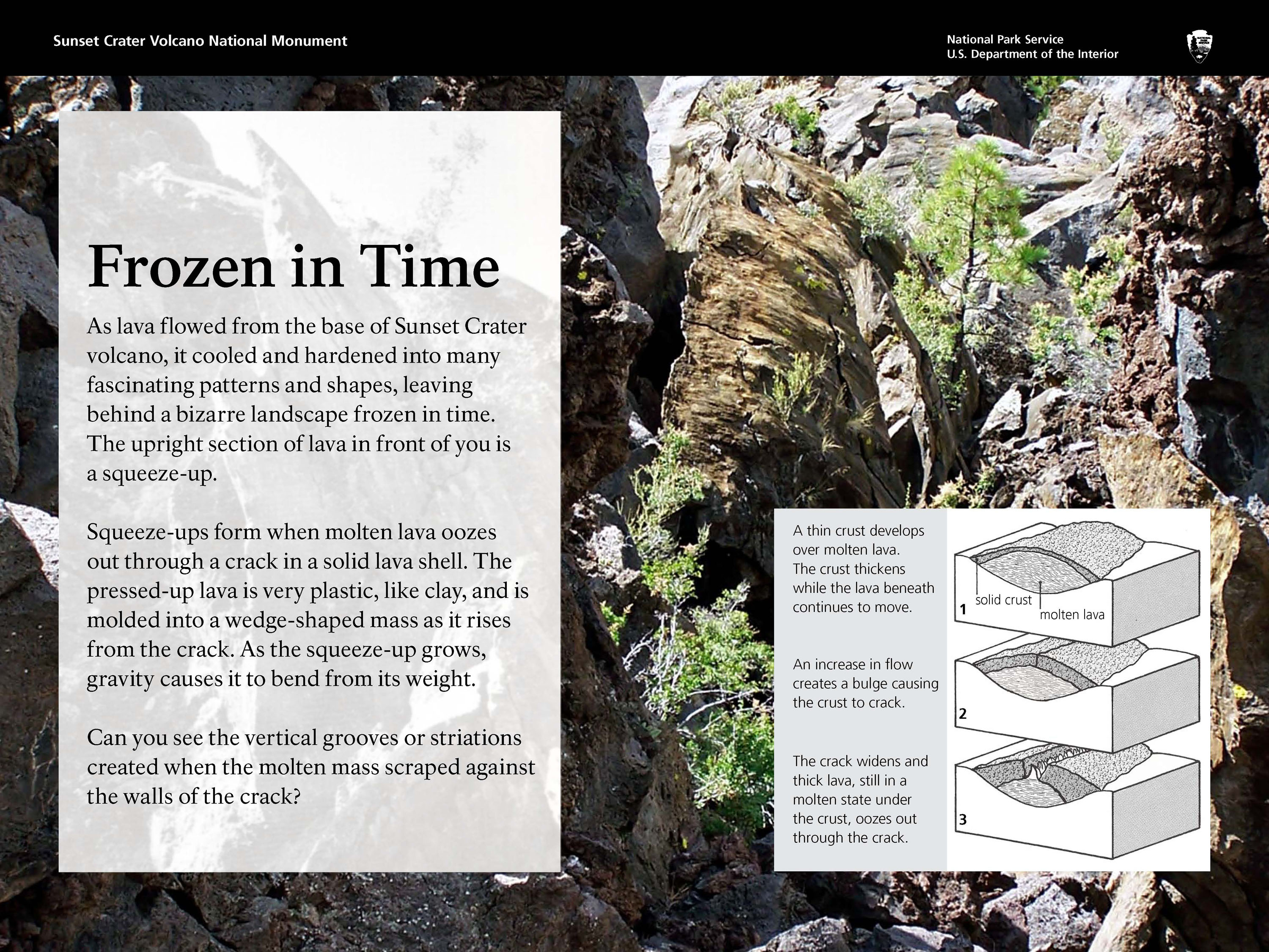
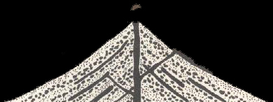
As lava flowed from the base of Sunset Crater volcano, it cooled and hardened into many fascinating patterns and shapes, leaving behind a bizarre landscape frozen in time. The upright section of lava in front of you is a squeeze-up. Squeeze-ups form when molten lava oozes out through a crack in a solid lava shell. The pressed-up lava is very plastic, like clay, and is molded into a wedge-shaped mass as it rises from the crack. As the squeeze-up grows, gravity causes it to bend from its weight. Can you see the vertical grooves or striations created when the molten mass scraped against the walls of the crack?
 What if scientists always agreed, never argued, or changed their minds?
Clues in Buried Homes: Until archeologists discovered Sinagua-style pithouses beneath the cinders, scientists did not suspect Sunset Crater was so young. Knowing the age of the pithouses from tree-ring dates and pottery types found in these homes, they concluded the eruption occurred after 1046 and before 1071.
Patterns in Tree Rings: Trees near an erupting volcano, if they are injured but continue to live, show a growth disturbance in their rings. Based on the growth pattern seen in three wood specimens from nearby Wupatki Pueblo, scientists hypothesized that the eruption occurred between the growing seasons of 1064 and 1065. But, this evidence is limited and inconclusive.
Magnetism in Rocks: Geologists have taken more than 100 core samples from the Sunset Crater lava flows for paleomagnetic studies. Using both paleomagnetic dating and stratigraphic evidence, geologists currently restrict the Sunset eruption to sometime between 1040 and 1100.
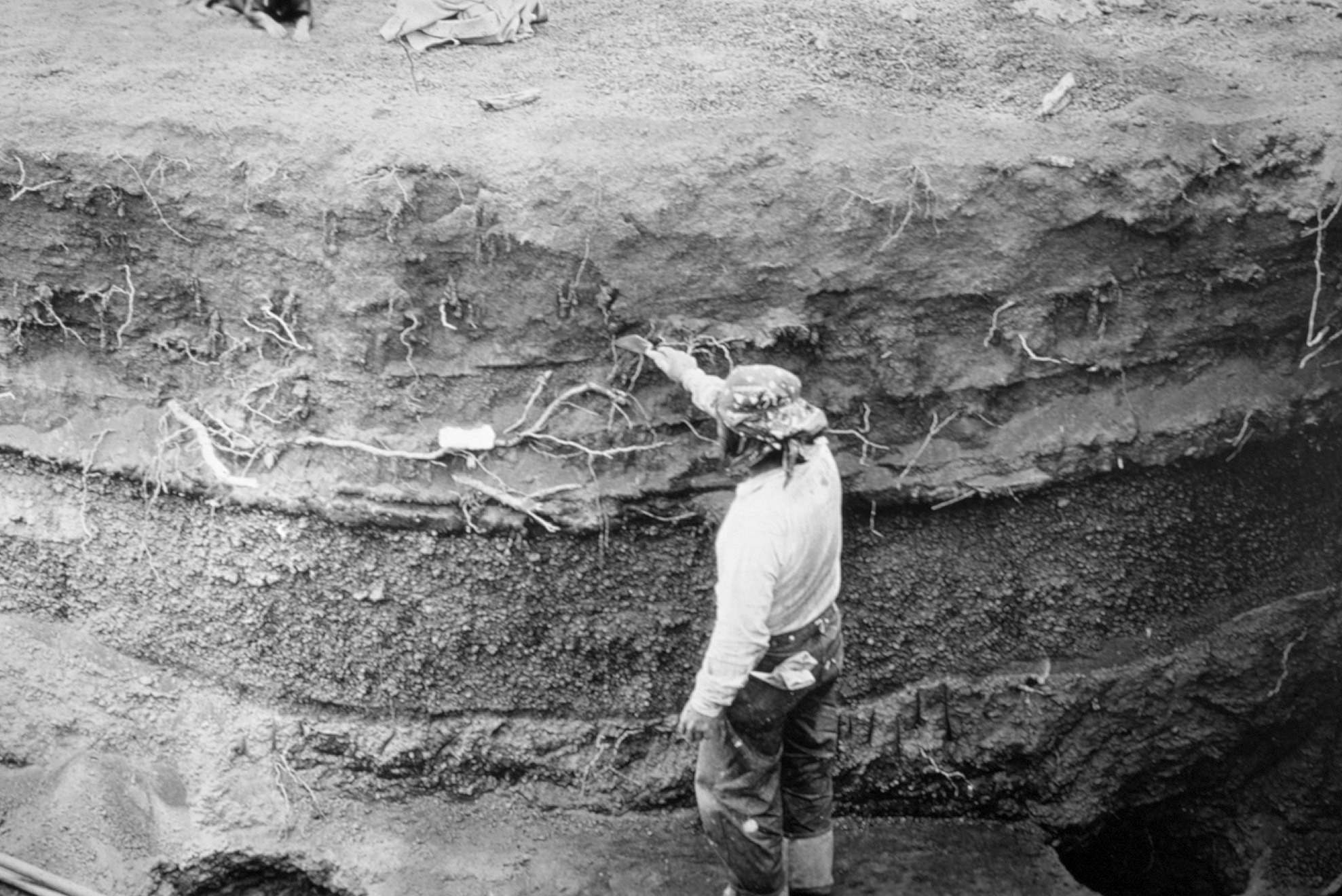
Stratigraphic profile.
 Most volcanoes are found along tectonic plate boundaries where continents and seafloors collide or move apart. We are far from a plate boundary; consequently, geologists debate why volcanoes occur here. One theory proposes that the North American plate is moving over a stationary “hot spot.” But this theory does not explain why there are young volcanic fields all along the southern margin of the Colorado Plateau and then east to New Mexico and Oklahoma.
Another more accepted theory focuses on a disruption in the flow of Earth’s mantle at the boundary between the Colorado Plateau, where the Earth’s crust is very thick, and the Basin and Range region (to the south and west), where the crust is very thin. At this transition, heat from the mantle rises and melting occurs. Ancient faults, activated by stretching of the North American plate (which has created the Basin and Range and is extending into the Colorado Plateau), serve as pathways for magma to move to the surface.
 On the horizon, the San Francisco Peaks rise as the highest mountains, forming the dominant feature of the san Francisco Volcanic Field. Imagine the sides continuing up to form one 16,000-foot-high mountain. This may be what the stratovolcano looked like about 500,000 years ago. The summit and flank of the volcano may have exploded and collapsed, much like Mount St. Helens. Erosion over thousands of years has created several peaks from the original volcano. Humphreys Peak, standing at 12,633 feet, is the tallest and is the highest peak in Arizona.
 How did they get their name? The peaks were named in 1629 by a group of Franciscan missionaries in honor of St. Francis of Assisi. In 1847, a small West Coast settlement on the verge of becoming a boom-town changed its name from Yerba Buena to San Francisco. This happened more than 300 years after the Arizona peaks were christened.
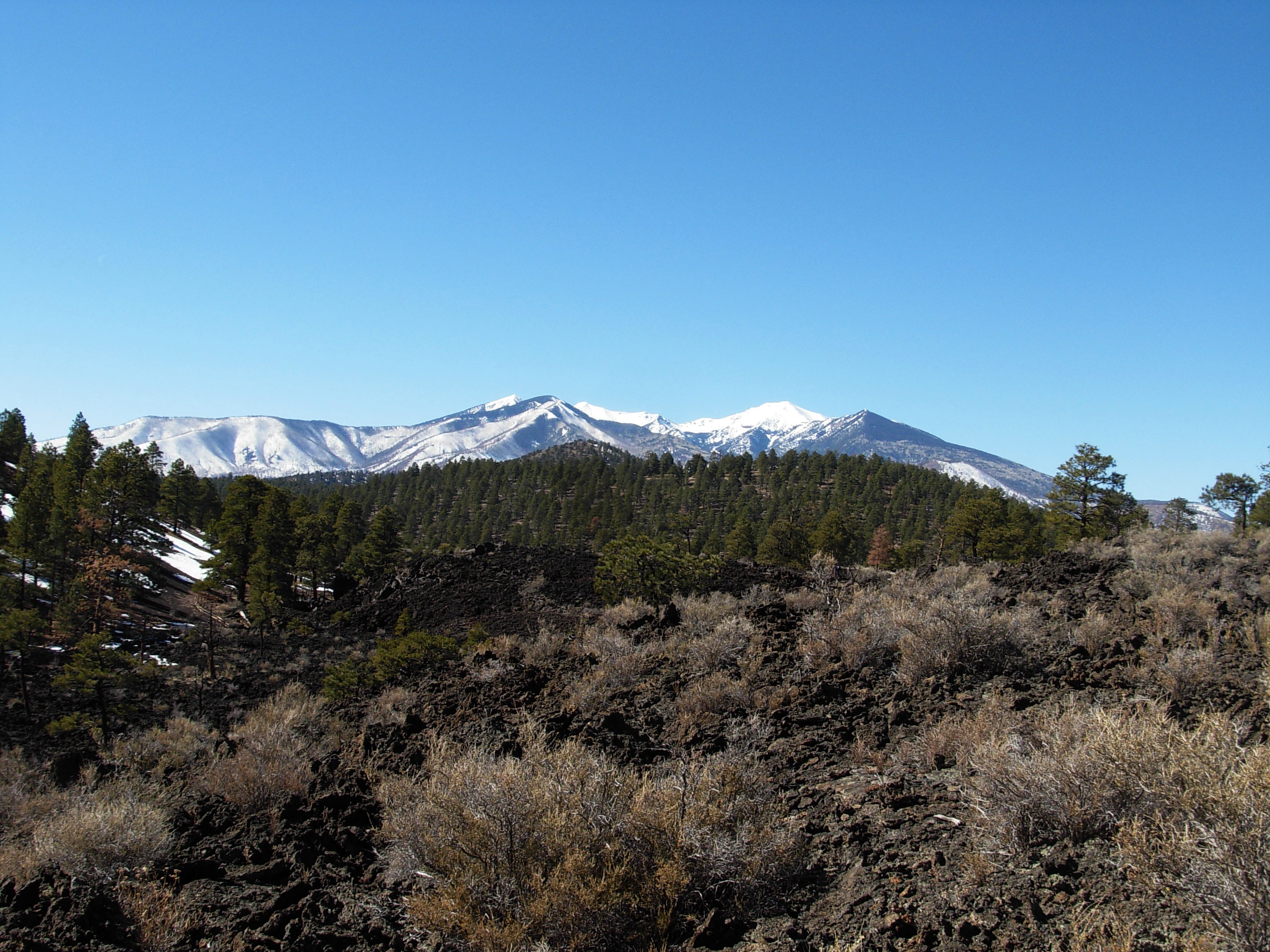
The San Francisco Peaks.
Volcanic eruptions may seem destructive but they are among the beneficial forces of a living planet: forces that build mountains, create oceans, and provide for live. Only when our planet has finished cooling will there be no volcanoes. Then, Earth will be a dead planet much like Mars.
 When the lava flowed and the cinder cone formed, all plant life within a several mile radius was destroyed. The oldest Ponderosa pine trees here today are about 400 years old and are probably not the first generation to return. Unlike Hawaii where abundant moisture promotes plant growth soon after eruptions, precipitation here averages only 16 inches (41 cm) a year. Furthermore, soil is sparse in this dry climate where water limits plant life and organic material breaks down slowly.
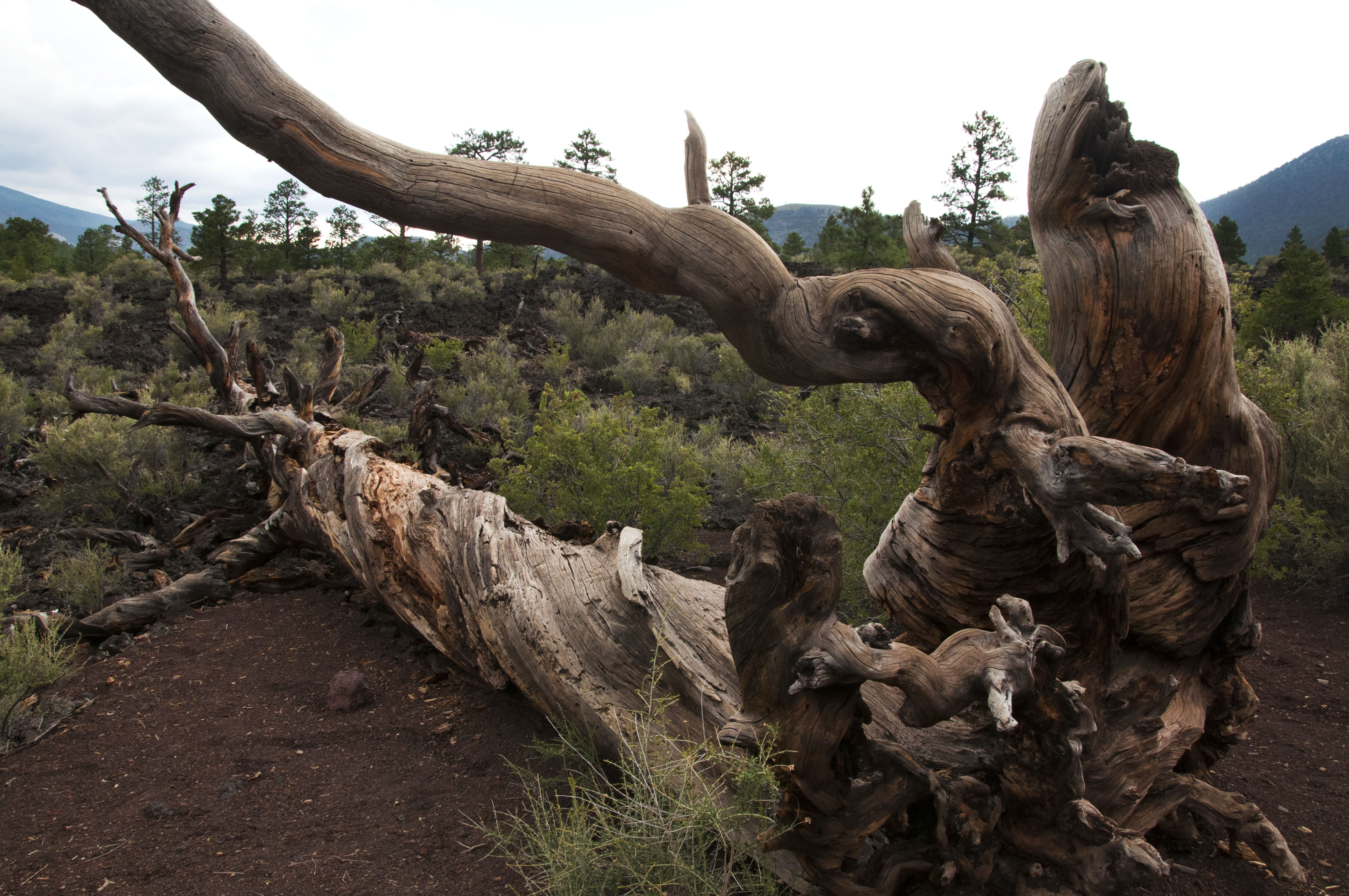
Roots on a dead Ponderosa pine.
Notice the massive trailing root system of this dead tree. Trees growing on these cinder slopes face extraordinary challenges in finding anchor in loose, unstable cinders and in capturing water as it drains rapidly through them. Notice also how this tree spiraled as it grew. Ponderosa pines grow either straight or dextrally (spiraling to the right). Spiral growth reduces the overall strength of a tree but increases its flexibility. The spiral grain also provides an even distribution of water from a single root to all of the needles and of nutrients from a single branch to all the roots. In a straight tree, wind-damaged branches or damaged roots would deprive water and nutrients to the roots directly below and branches directly above. By spiraling, this tree was better adapted to the stresses of its environment: lack of water, high winds, and occasional heavy snow. But it wasn’t able to remain anchored when its roots were exposed by erosion from foot traffic.
 On the slope below you is a small spatter cone. Spatter cones, or hornitos (“little ovens” in Spanish), form when lava is forced up through an opening in the cooled surface of a lava flow. They are “rootless,” fed by the underlying flow rather than a deep magma conduit. Can you picture fluid fragments of liquid spurting upward, flattening, congealing, and mounding around the opening?
Can you imagine approaching an erupting spatter cone? Unique artifacts found nearby – corn casts in lava rock – suggest people did. Experiments conducted in Hawaii demonstrated that “corn rocks,” like the one on display in the visitor center, can form when ears of corn are covered by fluid blobs of spatter. It appears people intentionally ventured close to an active hornito, maybe this one, to leave corn – perhaps as an offering. More than 50 rocks with corn casts have been found in homesites attributed to the local Sinagua cultural tradition.
Eroded spatter cone.
 Beneath the lava you now stand on are perhaps dozens of caves. As lava flowed, the top surface cooled first due to contact with air. A hardened crust formed. Meanwhile, rivers of lava continued flowing below, periodically breaking through the crust to form the spatter cones you saw earlier. When the flows ceased, the remaining lava drained out the downhill end of the crusted-over channels, leaving behind tube-like caves.
Most of these caves were sealed with hardened lava and have no openings to the surface. A collapse created the opening you see here.
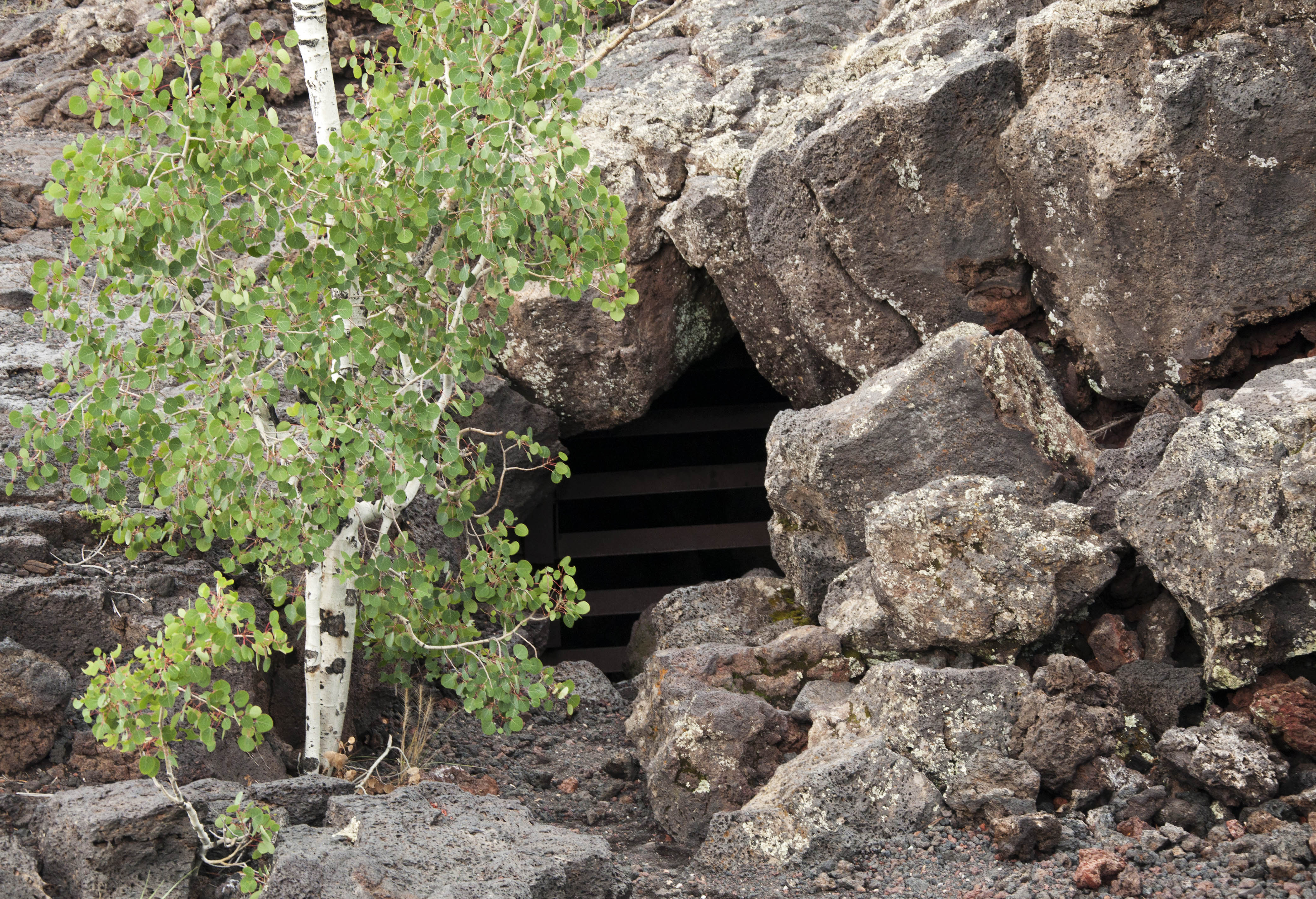
Opening to lava tube, now sealed for safety.
 Looking beyond the lava and spatter in front of you, and just beyond the line of trees, can you see a reddish hill? This is an agglutinate mound or pile of welded pyroclastic material.
In the early stages of the eruption, a cone began to form next to a major explosive vent. The cone became armored by welded deposits. Then a column of dense magma broke through the base of the cone, causing the upper part of the cone to collapse onto the top of the flow. The slumped pieces were then rafted away by the flowing lava. You are looking at a large piece of an early-stage cone of Sunset Crater.
Perhaps within weeks or days after breaching, the cone was rebuilt, creating the symmetrical cone of Sunset Crater we see today. Any remnants of the earlier cone lie buried beneath tons of cinder.
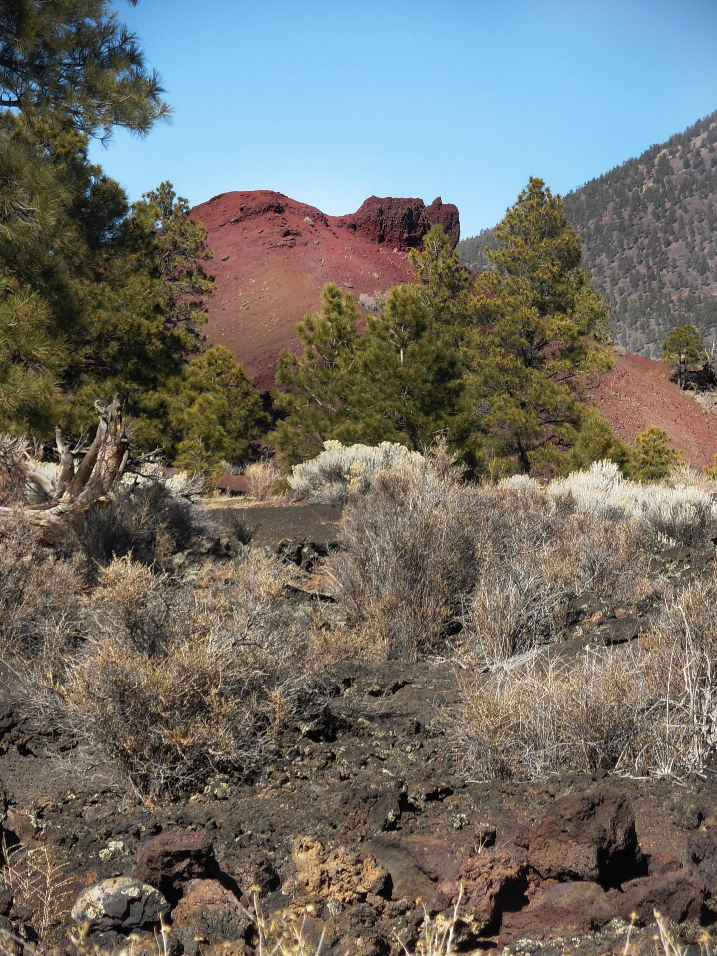
Agglutinate mound or pile of welded pyroclastic material.
 Notice the different patterns of vegetation around you. Volcanic eruptions alter plant communities, destroying some, creating new habitat for others, and changing growth rates for those remaining. On the lava flow in front of you most soil has come from wind-blown material that collects in cracks and holds water. Consequently, soil and moisture vary dramatically across the flow. And, since seeds blow in, colonization is quite random. Classic succession with lichens breaking down rock into soil, and plants returning in predictable sequence is not occurring here.
 As plants return to the barren landscape, so do the animals that use the plants for food and shelter. Many animals that live here are nocturnal. Some take shelter in the lava flow. Others blend in so well with their surroundings that they are difficult to spot. A careful observer may see evidence such as tracks or droppings.
Along the perimeter of the flow, a unique microhabitat for plants exists. In places, water collects on the surface of the flow and is then channeled through fractures to the edge where it locally benefits plants. White-barked aspen trees grow around the perimeter of the flow and along fracture systems.
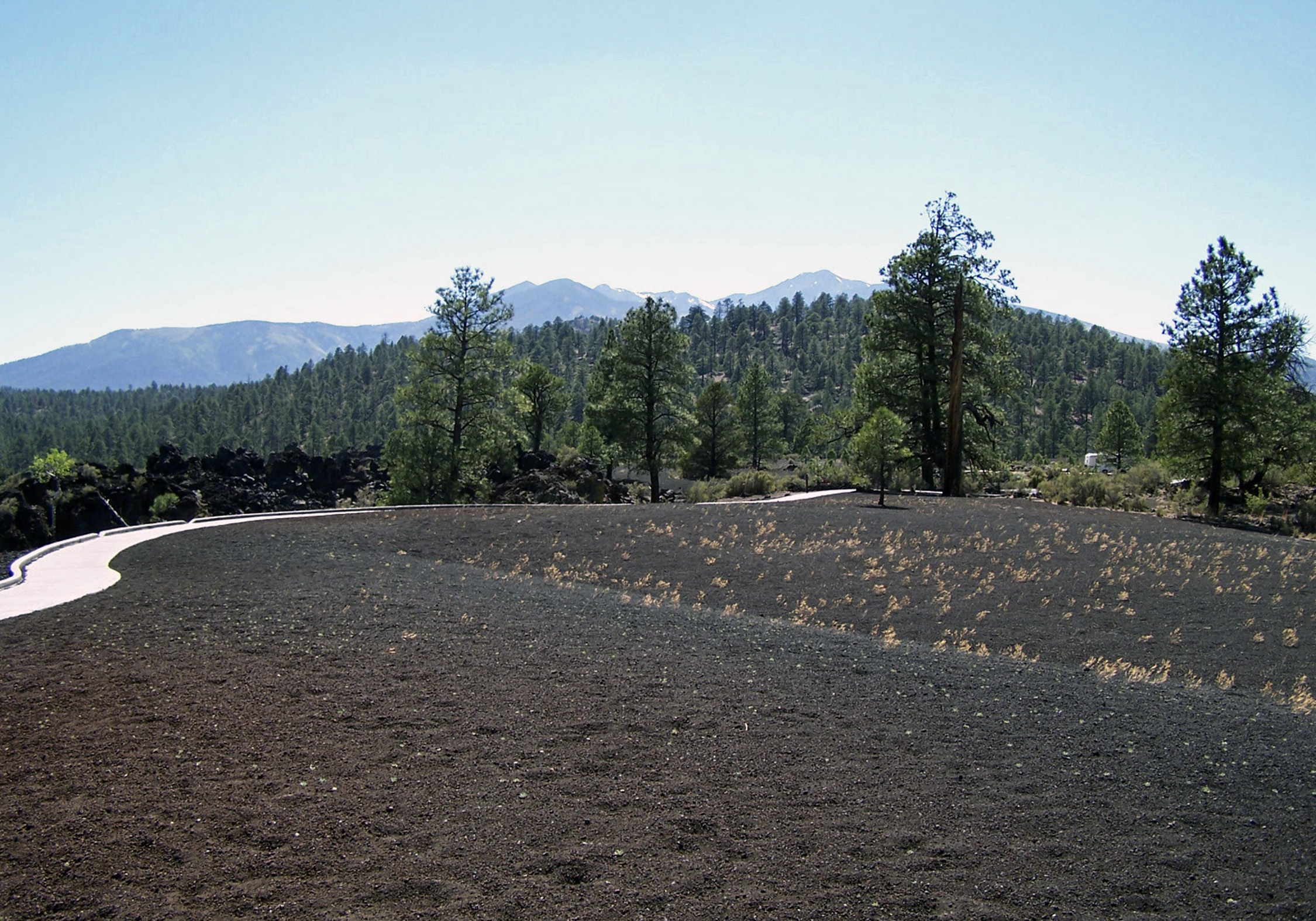
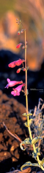
In area of deep cinder, like the dunes in the distance to your left, specialized plants have evolved. The Sunset Crater penstemon evolved new traits which allow it to live on cinder soils but also make this endemic plant dependent on this habitat. It cannot survive elsewhere.
 From the earliest times, people have enjoyed the long-term benefits of volcanic eruptions. People journeyed long distances to volcanic areas to gather materials for their daily lives, including important minerals, raw materials like obsidian for tools, and building supplies. And always, in return for these benefits, people have paid a high short-term price in the form of volcanic disasters.
Our culture influences how we forecast events, choose to prepare and adapt to catastrophes, and how we explain our world and its phenomena. Some of us look to science, some to religion, and some to traditional knowledge. It is not surprising that worldwide, when people live near volcanoes, they often develop related rituals and belief systems. This eruption was a significant event in the lives of the native peoples of the Southwest, and today all of the region’s American Indian groups consider this a scared landscape.
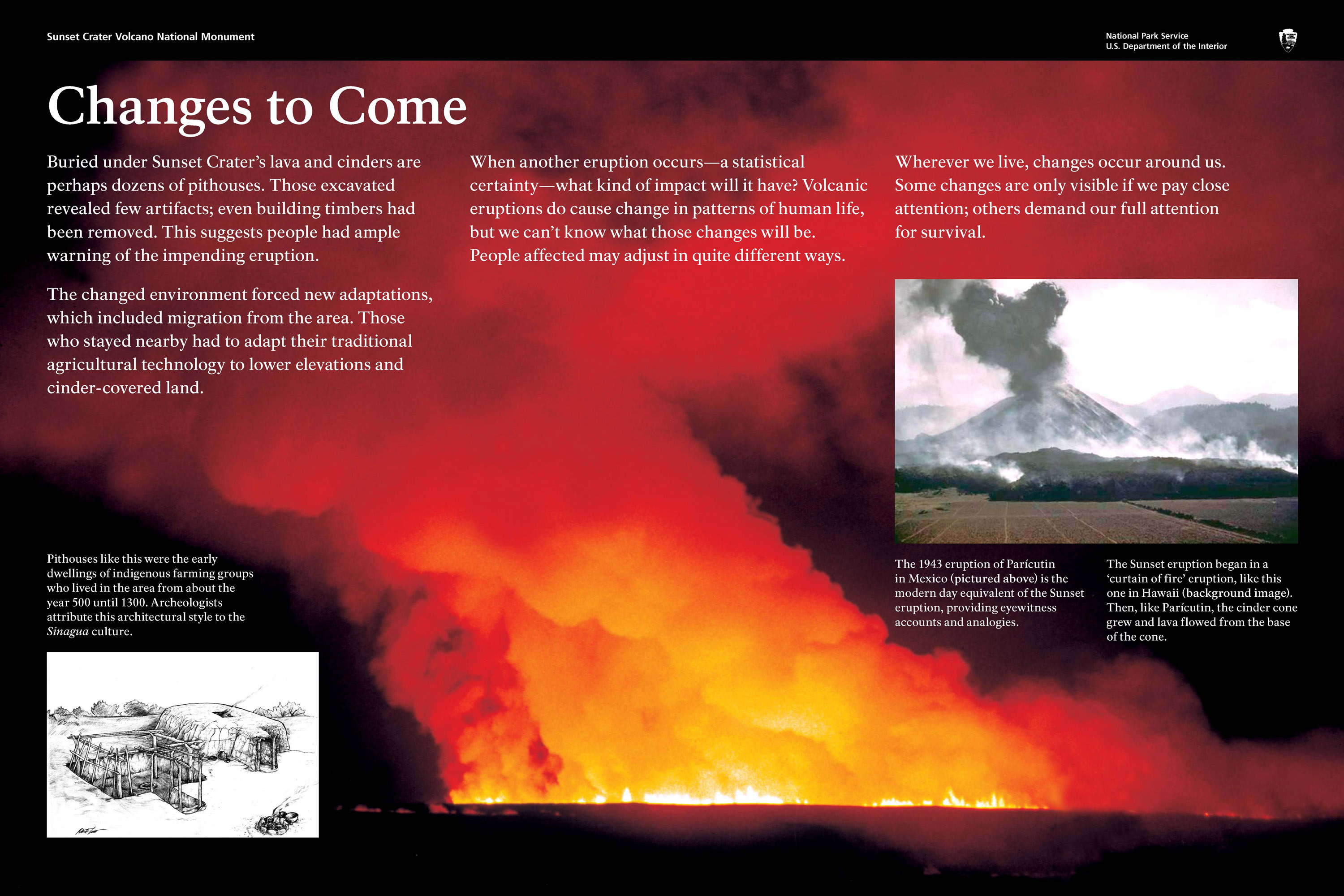
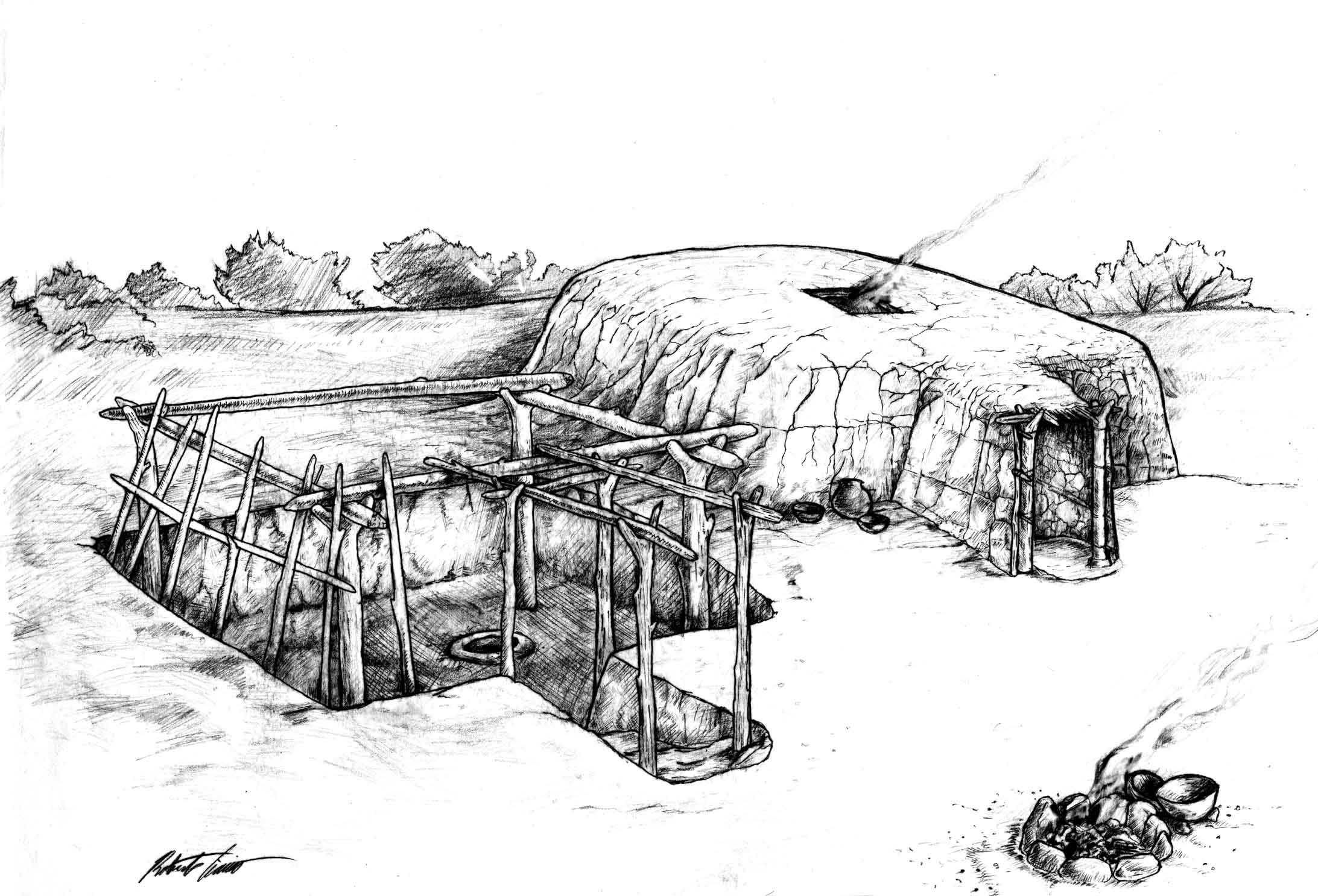
Buried under Sunset Crater’s lava and cinders are perhaps dozens of pithouses. Those excavated revealed few artifacts; even building timbers had been removed. This suggests people had ample warning of the impending eruption. The changed environment forced new adaptations, which included migration from the area. Those who stayed nearby had to adapt their traditional agricultural technology to lower elevations and cinder-covered land. When another eruption occurs—a statistical certainty—what kind of impacts will it have? Volcanic eruptions do cause change in patterns of human life, but we can’t know what those changes will be. People affected may adjust in quite different ways. Wherever we live, changes occur around us. Some changes are only visible if we pay close attention; others demand our full attention for survival.
The ancestors of today’s Hopi and Zuni Indians witnessed the eruption.
In some Hopi accounts, the Qa’na Katsina caused Palatsmo (Sunset Crater) to erupt after people engaged koyaanisqatsi, a life out of balance. For Hopi people, Palatsmo is a living reminder: if people stray from their religious ideals and lifeway, there may be another eruption.
In Zuni traditions, stories of the eruption were carefully guarded because of the belief if people continually dwell upon negative events those events will happen.
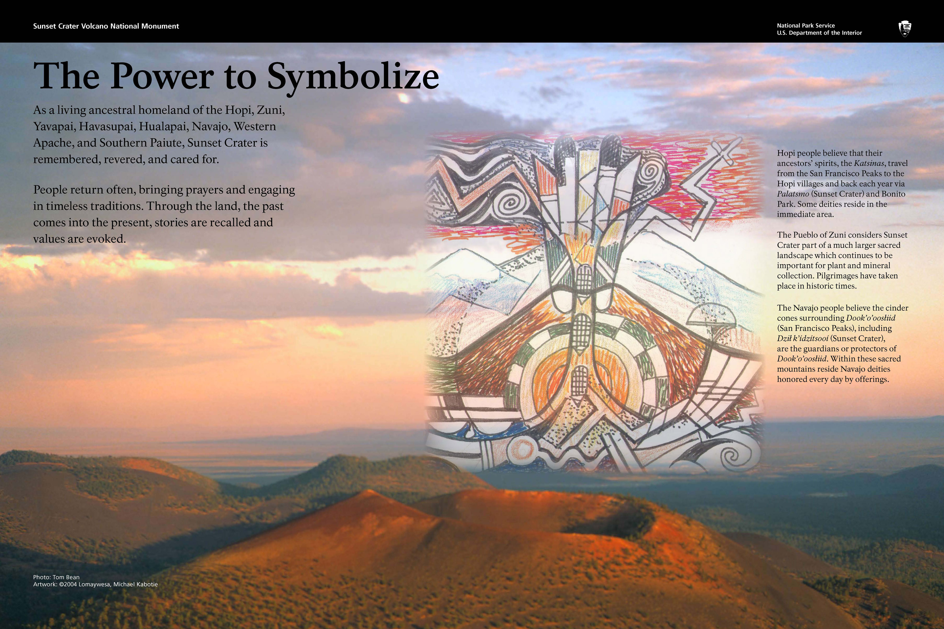
As a living ancestral homeland of the Hopi, Zuni, Yavapai, Havasupai, Hualapai, Navajo, Western Apache, and Southern Paiute, Sunset Crater is remembered, revered, and cared for. People return often, bringing prayers and engaging in timeless traditions. Through the land, the past comes into the present, stories are recalled and values are evoked.
Regardless of our worldview, places like Sunset Crater Volcano National Monument help us to better understand each other and the forces that continually affect our lives.